The Sierra Nevada mountain range, a granite spine piercing the California sky, holds within its embrace one of the world’s most revered long-distance trails: the John Muir Trail (JMT). For hiking enthusiasts, the prospect of hiking the John Muir Trail California represents the pinnacle of wilderness adventure, a pilgrimage through some of the most breathtaking alpine scenery on Earth. This comprehensive guide aims to equip aspiring JMT hikers with the knowledge, inspiration, and practical advice needed to transform that dream into a tangible, life-altering experience.
The JMT, affectionately known as “America’s Most Beautiful Trail,” stretches approximately 211 miles (340 km) through Yosemite, Kings Canyon, and Sequoia National Parks, as well as several wilderness areas, including the Ansel Adams and John Muir Wildernesses. It traverses a landscape of towering granite peaks, pristine alpine lakes, lush meadows, and ancient forests, all while staying predominantly above 8,000 feet (2,400 m) in elevation. The journey culminates at the summit of Mount Whitney, the highest peak in the contiguous United States, standing at a majestic 14,505 feet (4,421 m).
This trail is more than just a physical challenge; it is an immersion into the raw power and serene beauty of nature, a chance to disconnect from the demands of modern life and reconnect with the rhythms of the wild. As experienced hikers, we understand the allure and the profound impact such a journey can have. Let us delve into the essential aspects of planning and undertaking this extraordinary adventure.
The John Muir Trail: A Journey Through Time and Terrain
The vision for a continuous trail along the backbone of the High Sierra originated with Theodore Solomons in 1884. His advocacy, alongside the efforts of the Sierra Club (co-founded by the trail’s namesake, John Muir), eventually led to the trail’s construction, which began in 1915, a year after Muir’s passing. The final section, over the challenging Forester Pass, was completed in 1938, creating the continuous route hikers cherish today.
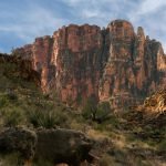
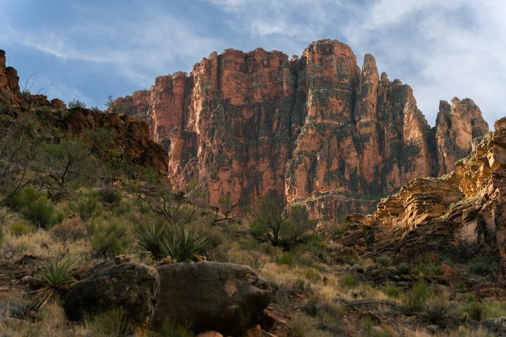
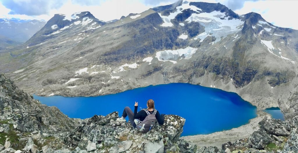
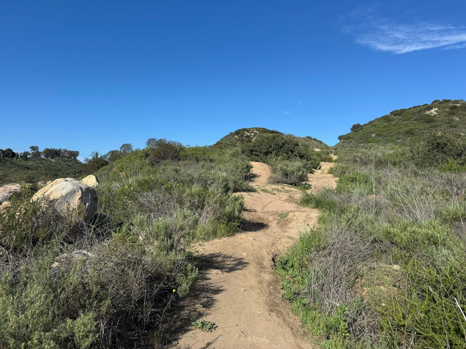
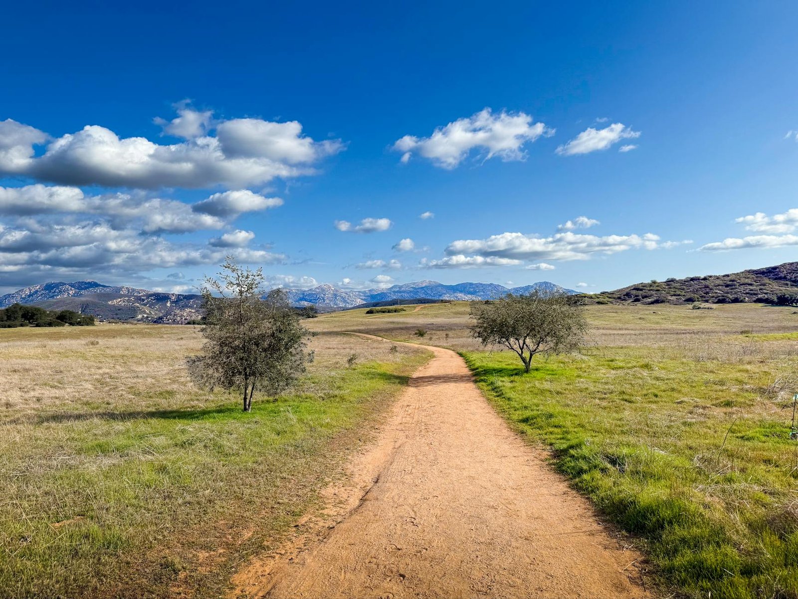
The JMT’s path is a testament to the grandeur of the Sierra Nevada. Starting from Happy Isles in Yosemite Valley, at an elevation of about 4,040 feet (1,230 m), the trail gradually ascends, allowing hikers to acclimatize to the increasing altitude. The route weaves through iconic landscapes such as Tuolumne Meadows, a vast subalpine meadow, and past the dramatic granite formations of Half Dome. Further south, hikers enter the Ansel Adams Wilderness, encountering breathtaking vistas around Thousand Island Lake and Garnet Lake.
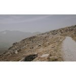
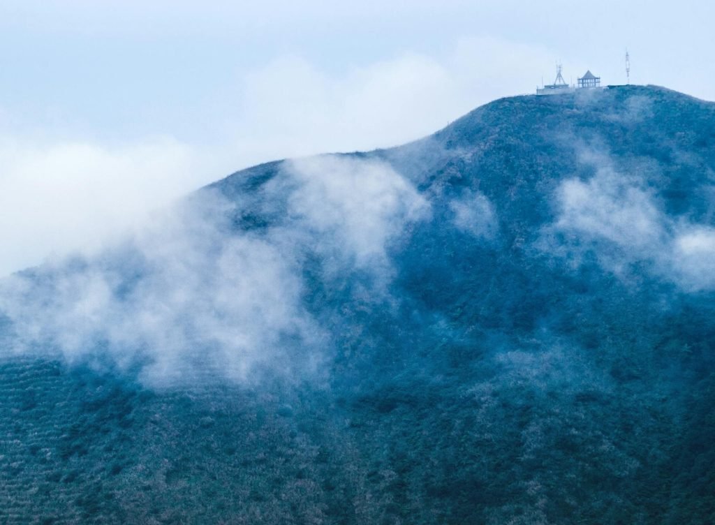
As the trail progresses into Kings Canyon National Park and Sequoia National Park, the terrain becomes even more rugged and spectacular. Hikers navigate a series of high mountain passes, each offering unique challenges and unparalleled panoramic views. Notable passes include Donohue Pass, Muir Pass (home to the historic Muir Hut), Mather Pass, Pinchot Pass, Glen Pass, and the highest point on the Pacific Crest Trail, Forester Pass, which reaches 13,153 feet (4,009 m). The cumulative elevation gain along the JMT is approximately 47,000 feet (14,000 m) when hiking southbound, with a corresponding descent of about 38,000 feet (11,582 m).
The journey culminates with the ascent of Mount Whitney, a strenuous but incredibly rewarding climb that offers sweeping views across the High Sierra. From the summit, hikers typically descend to Whitney Portal, marking the traditional end of the thru-hike.
Essential Preparations for Hiking the John Muir Trail California
Undertaking a JMT thru-hike demands meticulous planning and preparation. This is not a casual stroll; it is a multi-week expedition into remote wilderness. Proper planning is paramount to a safe and enjoyable experience.
Permits: Your Golden Ticket to the Wilderness
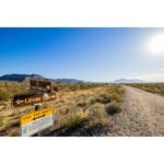
Securing a wilderness permit is arguably the most challenging aspect of planning a JMT thru-hike. The trail’s immense popularity means permits are highly competitive and issued through a lottery system. There isn’t a single “JMT permit”; instead, hikers apply for permits from the agency managing their chosen entry trailhead.
- Southbound (SOBO) from Yosemite: Most hikers prefer to start southbound from Happy Isles in Yosemite Valley, as it allows for gradual acclimatization to elevation. Permits for Happy Isles (Donohue Pass eligible) or Lyell Canyon are obtained via a weekly lottery on Recreation.gov, typically requiring applications 24 weeks in advance of the desired entry date.
- Northbound (NOBO) from Mount Whitney: For those wishing to hike northbound, permits starting from Whitney Portal are also highly sought after. The lottery for these permits is usually open from February 1st to March 1st for trips between May 1st and November 1st, with results announced in mid-March.
- Inyo National Forest Entry Points: Alternative entry points, such as those via Cottonwood Pass or Cottonwood Lakes in the Inyo National Forest, can sometimes offer slightly better permit availability, with 60% of quotas released six months in advance and 40% two weeks prior.
It is crucial to understand the specific regulations for your chosen entry and exit points and to be prepared for the competitive nature of the lottery. Flexibility with start dates can significantly increase your chances of success.
You might also enjoy: Conquer the Ancient Heart: A Comprehensive Guide to Hiking Australia’s Larapinta Trail
Physical Conditioning: Building a Resilient Body
The JMT is physically demanding, with significant elevation changes daily. Hikers will spend most of their time at altitudes between 10,000 and 13,000 feet (3,000-4,000 m). A robust training regimen is essential. This should include:
- Cardiovascular Endurance: Regular hiking, running, or cycling to build stamina.
- Strength Training: Focusing on legs, core, and back muscles to carry a loaded pack over varied terrain.
- Backpacking Practice: Undertaking multi-day hikes with a fully weighted pack to simulate trail conditions and test gear.
- Altitude Acclimatization: If possible, spending a few days at moderate elevation (e.g., in Yosemite Valley or Mammoth Lakes) before starting the hike can help mitigate the effects of acute mountain sickness.
Gear Selection: Every Ounce Counts
Lightweight but durable gear is key. Hikers typically carry all their essentials for 2-3 weeks, with resupply stops. Key items include:
- Backpack: A comfortable, well-fitting pack capable of carrying 5-7 days of food and gear.
- Shelter: A lightweight tent, tarp, or bivy sack suitable for alpine conditions.
- Sleeping System: A sleeping bag rated for temperatures potentially below freezing, especially at higher elevations, and a sleeping pad.
- Cooking System: A lightweight stove, fuel, and cooking pot.
- Water Filtration: A reliable water filter or purification tablets, as water sources are abundant but require treatment.
- Navigation Tools: Essential for safety and route-finding.
- Bear Canister: Mandatory for storing all food and scented items.
- Clothing Layers: A versatile layering system to adapt to rapidly changing weather, including waterproof outer shells, insulating layers, and sun protection.
Resupply Strategy: Fueling Your Journey
Given the trail’s length and the need to carry limited food, a well-planned resupply strategy is crucial. Most hikers arrange 2-3 resupply drops along the trail. Common resupply points, listed from north to south, include:
- Tuolumne Meadows (approx. JMT Mile 23): An early stop for southbound hikers, offering a store and post office.
- Red’s Meadow (approx. JMT Mile 60): A popular and convenient stop with a general store, restaurant, showers, and laundry.
- Vermilion Valley Resort (VVR) (approx. JMT Mile 88): Requires a side trip (often involving a ferry across Lake Edison) but is very hiker-friendly.
- Muir Trail Ranch (MTR) (approx. JMT Mile 108-111): A remote ranch that accepts resupply packages and is often the last convenient resupply for southbound hikers before the long push to Mount Whitney.
- Kearsarge Pass / Onion Valley (approx. JMT Mile 174-195): This involves a significant detour off the JMT (about 7 miles to Onion Valley trailhead, then hitchhiking to Independence) but can be vital for breaking up the long final stretch.
Hikers typically mail pre-packaged food boxes to these locations. Always check the specific requirements, fees, and operating hours for each resupply point well in advance.
Navigation and Safety Considerations on the John Muir Trail California
While the JMT is generally well-marked, navigating the High Sierra requires vigilance and preparedness. Safety should always be the top priority.
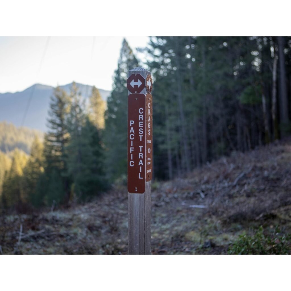
Navigation Tools: Staying on Course
Even experienced hikers carry multiple navigation aids.
- Paper Maps: Topographic maps, such as those from Tom Harrison or National Geographic, are indispensable. They are waterproof and tear-resistant, providing crucial detail.
- Compass: Knowing how to use a compass in conjunction with your maps is a fundamental wilderness skill.
- GPS Device/App: Smartphone apps like FarOut (formerly Guthook), Gaia GPS, or CalTopo offer detailed trail information, including waypoints, water sources, and elevation profiles, and work offline. These should complement, not replace, paper maps.
Weather and Terrain Challenges: Respecting the Mountains
The Sierra Nevada is known for its generally stable summer weather, but conditions can change rapidly.
- Afternoon Thunderstorms: Common in July and August, bringing sudden rain, lightning, and hail. Always carry rain gear and be prepared to seek shelter.
- Temperature Swings: Daytime temperatures can range from the 60s to low 80s Fahrenheit (15-27°C) at lower elevations, but nights in the alpine can drop below freezing. Layered clothing is essential.
- Snow and Water Crossings: Early season (June-early July) hikers may encounter significant snow on high passes and swollen, potentially dangerous river crossings from snowmelt. Microspikes or an ice axe might be necessary depending on the snowpack.
- Altitude Sickness: The high elevations can cause headaches, nausea, and fatigue. Ascend slowly, stay hydrated, and be aware of symptoms. Descend immediately if symptoms worsen.
- Wildfires: A growing concern in late summer and early fall (September), wildfire smoke can impact air quality and lead to trail closures. Monitor conditions before and during your hike.
Wildlife Encounters: Coexisting with Nature
The JMT is home to diverse wildlife, including black bears, deer, marmots, and various bird species. Proper food storage is critical to protect both hikers and wildlife.
- Bear Canisters: Required throughout the JMT for all food, trash, and scented items. These must be stored at least 50 feet (15 meters) from your sleeping area.
- Marmots: These curious rodents are known for chewing through unattended gear to access salty items. Keep your pack secure.
- Respect Wildlife: Observe animals from a distance, never feed them, and store all attractants properly.
Environmental Stewardship: Protecting the Pristine
The John Muir Trail traverses designated wilderness areas, places managed to preserve their natural character. Adhering to Leave No Trace principles is not just a suggestion; it is a responsibility for every hiker.
- Plan Ahead and Prepare: Know the regulations for the areas you’ll visit.
- Travel and Camp on Durable Surfaces: Stay on established trails and camp at least 100 feet (30 meters) from water sources and trails.
- Dispose of Waste Properly: Pack out everything you pack in, including all trash, food scraps, and toilet paper. Use catholes for human waste, buried 6-8 inches deep and 200 feet from water, camp, and trails. Waste kits are required in the Whitney Zone.
- Leave What You Find: Do not disturb natural or cultural artifacts.
- Minimize Campfire Impacts: Use existing fire rings, keep fires small, and ensure they are completely out. Check local fire restrictions, as campfires are often prohibited. A California Campfire Permit is required for open fires and portable stoves on federal lands.
- Respect Wildlife: Observe from a distance and never feed animals.
- Be Considerate of Other Visitors: Yield to other hikers, keep noise levels down, and preserve the solitude of the wilderness.
Personal Insights from the Trail (as Summit Reid)
Having spent countless weeks navigating the rugged beauty of the Sierra, the John Muir Trail holds a special place in our collective hiking memory. The trail has a way of stripping away the superfluous, leaving one with a profound appreciation for simplicity and the raw power of nature. We recall one particular morning, waking before dawn at Guitar Lake, the air crisp and still, the stars a dazzling tapestry above. The climb to Mount Whitney’s summit that day was arduous, but with each step, the vastness of the landscape unfolded, a testament to the enduring spirit of the mountains.
You might also enjoy: Unveiling Yosemite’s Majesty: A Hiker’s Ultimate Guide to Its Legendary Trails
The camaraderie on the JMT is another unforgettable aspect. We’ve shared dehydrated meals with strangers who quickly became friends, exchanging stories and encouragement under skies so clear the Milky Way felt within reach. There’s a unique bond forged when facing challenges together, whether it’s navigating a tricky snowfield near Forester Pass or celebrating a successful resupply at Red’s Meadow. The trail fosters a sense of community, a shared understanding of the effort and reward inherent in such a journey.
We’ve learned that flexibility is perhaps the most valuable piece of gear one can carry. Plans, meticulously crafted over months, can change in an instant due to weather, an unexpected trail closure, or simply the desire to linger longer at a particularly stunning alpine lake. Embracing these shifts, adapting to the mountains’ whims, is part of the JMT experience. It teaches patience, resilience, and a deeper connection to the present moment.
The sheer scale of the landscape, from the dramatic waterfalls of Yosemite to the stark, windswept peaks surrounding Mount Whitney, is truly humbling. We remember standing atop Muir Pass, gazing at the Evolution Basin, feeling utterly tiny yet completely connected to the ancient forces that sculpted this land. It’s a feeling that stays with you long after the dust has settled from your boots.
Conclusion: Answer the Call of the High Sierra
Hiking the John Muir Trail California is an endeavor that transcends a typical backpacking trip; it is an odyssey into the heart of the Sierra Nevada, a journey of self-discovery amidst unparalleled natural beauty. It demands respect, preparation, and a commitment to environmental stewardship, but the rewards are immeasurable. The crisp alpine air, the shimmering lakes, the challenging passes, and the profound solitude combine to create an experience that will resonate for a lifetime.
For those who feel the pull of the High Sierra, who yearn for the challenge and the deep connection with nature that only a long-distance trail can provide, the John Muir Trail awaits. Begin your planning today, secure your permits, train diligently, and embrace the adventure. The mountains are calling, and a transformative journey is within your grasp. Will you answer?
Frequently Asked Questions
What is the best time of year for hiking the John Muir Trail California?
The ideal time for hiking the John Muir Trail is generally from July through September. This window typically offers the most favorable weather conditions, with most of the snow melted from high passes and before new snow begins to fall. Early September is often favored for fewer crowds and mosquitoes, though wildfire risk can increase.
How difficult is hiking the John Muir Trail?
The John Muir Trail is considered strenuous and requires significant physical fitness and backpacking experience. Hikers will navigate challenging terrain, including numerous high mountain passes, and spend most of their time at elevations above 8,000 feet (2,400 m). Acclimatization to altitude is crucial.
Are bear canisters required on the John Muir Trail?
Yes, approved bear canisters are mandatory for storing all food, trash, and scented items throughout the entire John Muir Trail, including all wilderness areas within Yosemite, Kings Canyon, and Sequoia National Parks, as well as the Inyo and Sierra National Forests. Rangers routinely check for compliance.
How long does it typically take to hike the John Muir Trail?
Most hikers complete the John Muir Trail in approximately 2-3 weeks, averaging about 10-15 miles (16-24 km) per day. The exact duration depends on individual fitness levels, desired pace, and the number of rest days or side trips taken. Planning for adequate time allows for a more enjoyable and less rushed experience.
Related Adventures
- Conquer the Ancient Heart: A Comprehensive Guide to Hiking Australia’s Larapinta Trail
- Unveiling Yosemite’s Majesty: A Hiker’s Ultimate Guide to Its Legendary Trails
- Unveiling the Majesty: Your Ultimate Guide to Hiking Routes in the Swiss Alps
⚠️ Safety Notice: This content is for informational purposes only. Always consult local guides and operators, verify current conditions, and ensure appropriate skills and certifications before any outdoor activity. DiveBikeHike is not responsible for injuries or incidents.