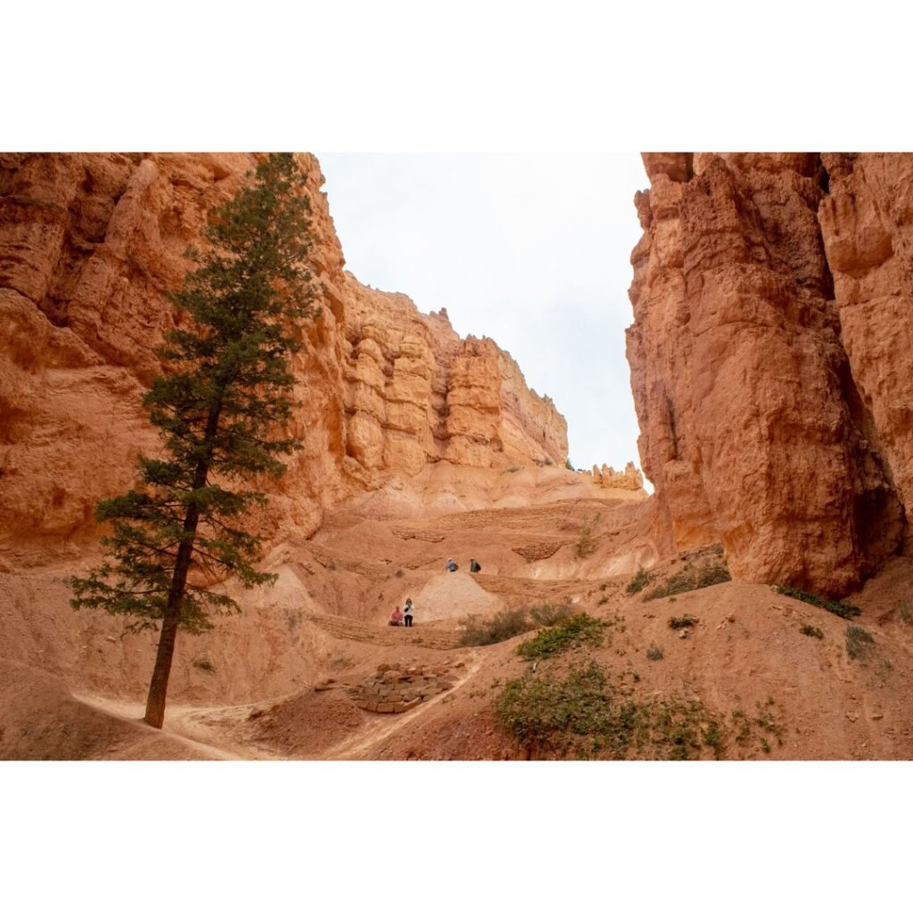
Bryce Canyon National Park, a geological wonderland nestled in Southern Utah, beckons adventurers with its surreal landscape of crimson-colored hoodoos, natural bridges, and vast amphitheaters. For hiking enthusiasts, exploring the diverse trails in Bryce Canyon National Park Utah is an experience that transcends the ordinary, offering a profound connection with nature’s artistry. From gentle rim strolls providing panoramic vistas to challenging descents deep into the canyon’s heart, Bryce Canyon promises an unforgettable journey for every skill level.
Understanding Bryce Canyon’s Unique Landscape
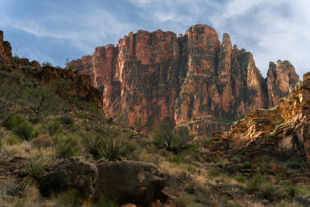
Bryce Canyon is not a single canyon but a series of natural amphitheaters carved into the eastern side of the Paunsaugunt Plateau. The park’s signature formations, known as hoodoos, are irregular columns of rock sculpted by millions of years of frost-wedging and chemical weathering. These vibrant pinnacles, ranging in color from white to pink, orange, and deep red, create a fantastical landscape that shifts with the changing light, offering endless photographic opportunities and a sense of awe. The park’s elevation, with the rim averaging around 8,000 feet (2,438 meters) and reaching over 9,000 feet (2,743 meters) at its highest points, contributes to its unique climate and offers expansive views that stretch for miles.
Iconic Trails in Bryce Canyon National Park Utah
The park boasts a variety of trails, each offering a distinct perspective of its geological wonders. We categorize them by difficulty to help hikers plan their adventures effectively.
Easy Trails: Rim Walks and Scenic Overlooks
For those seeking less strenuous options or looking to acclimate to the elevation, Bryce Canyon offers several accessible and rewarding trails:
- Rim Trail: Stretching approximately 5.5 miles (8.9 km) one-way from Bryce Point to Fairyland Point, the Rim Trail provides continuous, breathtaking views of the Bryce Amphitheater. The section between Sunrise Point and Sunset Point is paved, relatively flat, and about 0.5 miles (0.8 km) long, making it the easiest walk in the park and accessible for many visitors. This segment offers stunning vistas of the hoodoos below.
- Sunset to Sunrise Point: This 1.0-mile (1.6 km) round trip paved portion of the Rim Trail is considered the easiest hike and is pet-friendly. It offers spectacular views of the amphitheater.
- Bristlecone Loop: This easy 1.0-mile (1.6 km) loop meanders through spruce-fir forests atop the highest portion of the park, reaching elevations over 9,100 feet (2,778 meters). Hikers can see ancient bristlecone pines, some up to 1,800 years old, and enjoy expansive vistas.
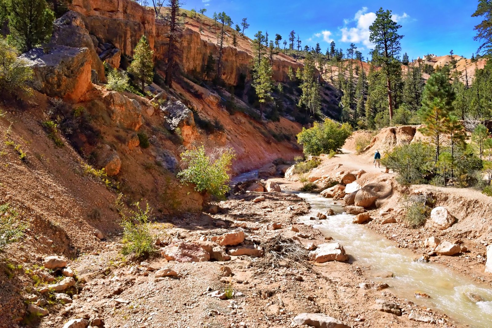
- Mossy Cave Trail: Located outside the main amphitheater area on Highway 12, this 0.8-mile (1.3 km) round trip trail is one of the lowest elevation hikes in the park. It leads to a mossy overhang and a small waterfall, which flows from May to October.
Moderate Trails: Descending into the Hoodoo Labyrinth
To truly immerse oneself in the hoodoo landscape, a descent below the rim is essential. These moderate trails offer a balance of challenge and reward:
- Queen’s Garden Trail: Considered the least difficult trail descending into the Bryce Amphitheater, this 1.8-mile (2.9 km) round trip trail takes hikers to unique rock formations, including one said to resemble Queen Victoria. It features an elevation change of about 320 feet (98 meters) and typically takes 1-2 hours.
- Navajo Loop Trail: Starting and ending at Sunset Point, this iconic 1.3 to 1.7-mile (2.2 to 2.7 km) loop trail is famous for its steep switchbacks that wind through narrow canyon walls, offering views of Thor’s Hammer and the bottom of Wall Street. The Wall Street section is often closed in winter, but the Two Bridges side remains open year-round. The trail involves a descent of about 352-550 feet.
- Queen’s/Navajo Combination Loop: This is arguably the park’s most popular hike, combining the Queen’s Garden and Navajo Loop trails for a 2.9-mile (4.6 km) journey. It offers a diverse experience, descending via Queen’s Garden and ascending the Navajo Loop, with an elevation change of approximately 600 feet (138 meters) and an average time of 2-3 hours.
- Tower Bridge Trail: This 3-mile (4.8 km) round trip moderate hike is part of the Fairyland Loop and leads to the impressive Tower Bridge hoodoo formation.
Strenuous Trails: For the Experienced Hiker
For those seeking a more challenging and extended adventure, these trails offer significant elevation changes and longer distances:
You might also enjoy: Discovering the Untamed Beauty: A Guide to Trails in Pacific Rim National Park Vancouver Island
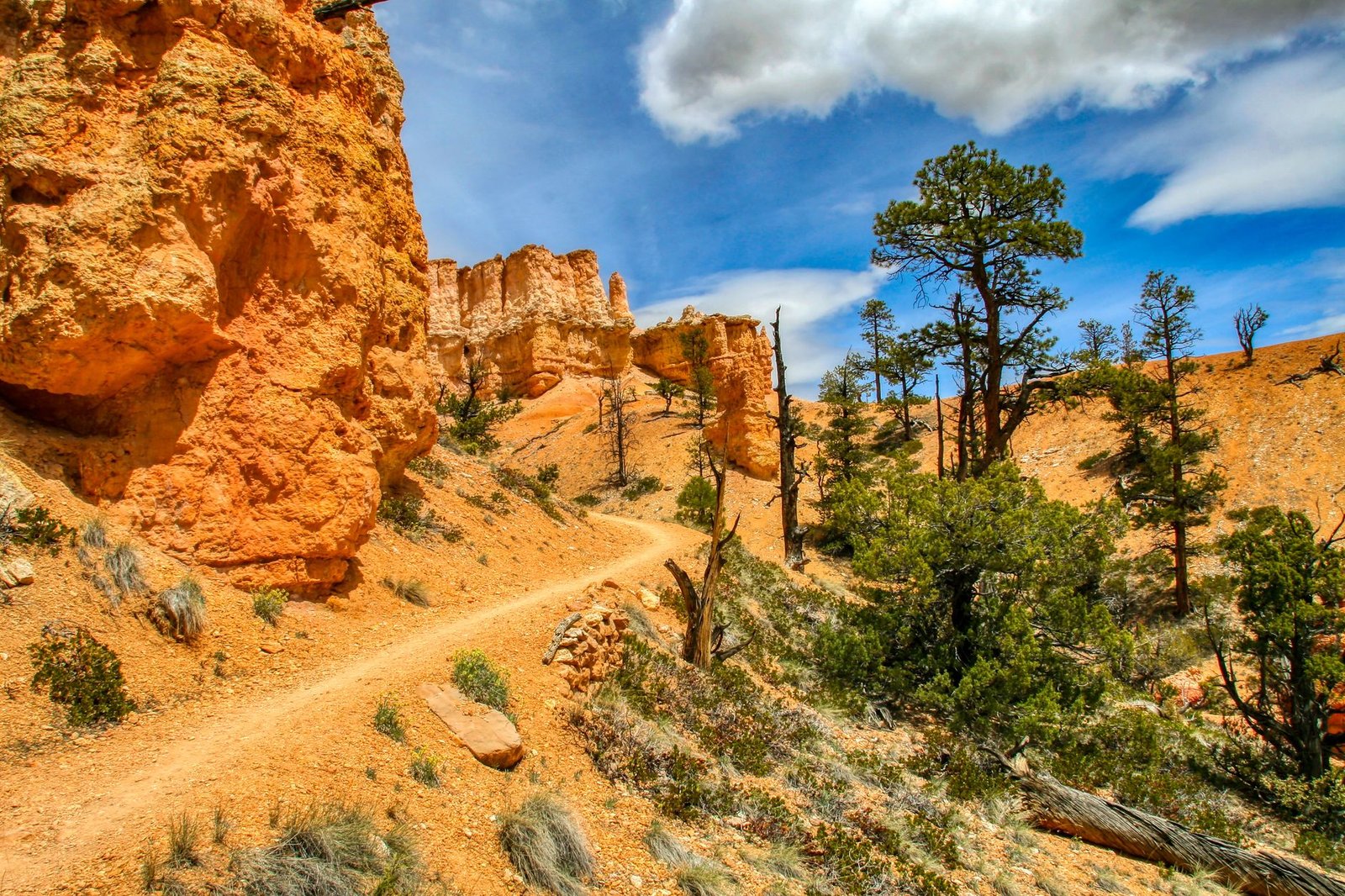
- Peek-A-Boo Loop Trail: This 5.5-mile (8.9 km) loop, starting from Bryce Point, descends 670 feet (204 meters) into a hoodoo-filled area, offering views of the Wall of Windows and The Organ. It is rated strenuous due to rapid elevation gain and longer length, with an elevation change of approximately 1,560 feet (474 meters) and an average time of 3-4 hours. Hikers may encounter horses and mules on this trail during summer months. It is recommended to hike this trail in a clockwise direction.
- Fairyland Loop Trail: This strenuous 8.0-mile (12.9 km) loop provides some of the best hiking in the park, offering an immersive experience among hoodoos within Fairyland and Campbell Canyons, as well as sections along the Rim Trail. It features an elevation change of about 1,500-1,716 feet (457-523 meters) and takes approximately 4-5 hours. Many hikers prefer to hike it counter-clockwise for a less steep ascent at the end.
Planning Your Hiking Adventure
Careful planning is crucial for an enjoyable and safe hiking experience in Bryce Canyon.
Best Time to Visit
The ideal time to visit Bryce Canyon for hiking is during the late spring (May-June) and early fall (September-October). During these shoulder seasons, temperatures are comfortable, ranging from 50°F to 70°F (10°C to 21°C), and the crowds are generally thinner than in summer. Summer (June-August) offers warm, sunny weather with average highs of 73-79°F (23-26°C), but also brings the largest crowds and frequent afternoon thunderstorms. Winter (December-February) offers a unique, snow-covered landscape and solitude, but temperatures are cold (highs in the 30s F, lows in the teens F), and some trails or sections may be closed due to snow and ice.
Practical Preparation Advice
- Hydration: The high desert environment and elevation mean rapid dehydration. We recommend carrying at least one gallon (approximately 3.8 liters) of water per person per day, especially for longer hikes.
- Layered Clothing: Weather can change quickly. Dress in layers to adapt to fluctuating temperatures, from cool mornings to warm afternoons and potentially chilly evenings.
- Sturdy Footwear: Trails can be steep, rocky, and have loose gravel. Wear well-broken-in hiking boots with good ankle support and traction.
- Sun Protection: The high altitude means stronger UV radiation. Bring sunscreen, a wide-brimmed hat, and sunglasses.
- Navigation: Carry a detailed park map, compass, or a reliable GPS device. Cell service can be unreliable in many areas of the park.
- Snacks: Pack energy-rich snacks to maintain energy levels throughout your hike.
Navigation and Safety Considerations
Safety is paramount when exploring the trails in Bryce Canyon National Park Utah.
- Stay on Marked Trails: Venturing off-trail can damage the fragile ecosystem and lead to dangerous situations, including getting lost or falling.
- Altitude Sickness: Bryce Canyon’s elevation (8,000-9,100 feet / 2,438-2,778 meters) puts visitors at risk of altitude sickness, especially those coming from sea level. Symptoms include headache, dizziness, muscle aches, and nausea. Acclimate by spending a day or two at a lower elevation before strenuous hiking, stay hydrated, and limit exertion. If symptoms persist or worsen, descend to a lower elevation.
- Weather Awareness: Afternoon thunderstorms are common in summer and can bring lightning and heavy rain. Check forecasts and be prepared to seek shelter. Snow and ice can make trails treacherous in spring, fall, and winter.
- Wildlife: While large, dangerous animals are rare, respect all wildlife. Observe from a distance and never feed animals.
- “Going Down is Optional, Coming Up is Mandatory”: Remember that all hikes into the canyon require an uphill return. Pace yourselves and turn back before becoming overly fatigued.
- Park Entrance Fees: A private vehicle pass is $35, valid for 7 days. As of January 1, 2026, non-U.S. residents aged 16 and over must pay an additional $100 per person fee unless admitted with an Annual or America the Beautiful Pass.
Environmental Stewardship
Protecting Bryce Canyon’s delicate environment is a shared responsibility. We encourage all hikers to practice Leave No Trace principles:
- Plan Ahead and Prepare: Know the regulations and special concerns for the areas you’ll visit.
- Travel and Camp on Durable Surfaces: Stay on marked trails to prevent erosion and protect fragile cryptobiotic soil.
- Dispose of Waste Properly: Pack it in, pack it out. This includes all trash, food scraps, and human waste (where facilities are not available, know how to properly bury human waste).
- Leave What You Find: Do not disturb cultural or natural features. Leave rocks, plants, and other natural objects as you find them.
- Minimize Campfire Impacts: Where fires are permitted, use established fire rings and keep fires small.
- Respect Wildlife: Observe animals from a distance. Never feed wildlife.
- Be Considerate of Other Visitors: Yield to other hikers on the trail, especially those coming uphill. Keep noise levels down.
Personal Insights from Summit Reid
As an experienced hiker, the trails in Bryce Canyon National Park Utah hold a special place in my heart. There’s a unique magic to stepping below the rim, leaving the expansive vistas behind for a more intimate encounter with the hoodoos. The scale of the formations truly becomes apparent when you’re walking among them, dwarfed by their towering presence. We recall one particular morning, descending the Navajo Loop as the first rays of sun painted the canyon walls in fiery hues of orange and red. The air was crisp, carrying the scent of pine, and the silence was profound, broken only by the crunch of our boots on the gravel. It was a moment of pure, unadulterated connection with the raw beauty of the earth. Each turn revealed a new sculpture, a new perspective, a new reason to pause and simply absorb the majesty. The climb back out, while challenging, felt like a triumphant return, carrying with us not just photographs, but a renewed sense of wonder and gratitude for these wild spaces.
Conclusion
Bryce Canyon National Park is a testament to nature’s enduring power to create landscapes of breathtaking beauty. The diverse trails offer something for everyone, from leisurely strolls along the rim to challenging descents into a world unlike any other. By planning diligently, prioritizing safety, and practicing environmental stewardship, we can ensure that these magnificent trails remain pristine for generations to come. So, gather your gear, prepare your spirit, and answer the call of the hoodoos. Your unforgettable adventure on the trails in Bryce Canyon National Park Utah awaits.
You might also enjoy: Picos de Europa: A Hiker’s Ultimate Guide to Spain’s Majestic Mountain Trails
Call to Action: Start planning your Bryce Canyon hiking adventure today! Explore the park’s official website for the latest trail conditions, shuttle information, and safety alerts.
Frequently Asked Questions
What are the must-do trails in Bryce Canyon National Park Utah for first-time visitors?
For first-time visitors, the Queen’s/Navajo Combination Loop is highly recommended. It’s a moderate 2.9-mile (4.6 km) hike that descends into the amphitheater, allowing hikers to experience the hoodoos up close and offering iconic views like Thor’s Hammer. For an easier option, the paved section of the Rim Trail between Sunrise and Sunset Points provides spectacular panoramic views.
Is altitude sickness a concern when hiking in Bryce Canyon?
Yes, Bryce Canyon’s elevation, ranging from 8,000 to 9,100 feet (2,438-2,778 meters), means altitude sickness is a real possibility. Symptoms can include headache, dizziness, and nausea. It is crucial to stay well-hydrated, limit strenuous activity upon arrival, and consider spending a day at a lower elevation to acclimate before undertaking challenging hikes.
Are there any permit requirements for hiking the trails in Bryce Canyon National Park Utah?
No specific hiking permits are generally required for day hikes on the established trails in Bryce Canyon National Park. However, a park entrance fee is required, which is typically $35 per private vehicle, valid for seven days. Backcountry permits are necessary for overnight stays.
What is the best time of year to avoid crowds on Bryce Canyon trails?
To avoid the largest crowds, consider visiting Bryce Canyon during the shoulder seasons of late spring (May-June) or early fall (September-October). While the weather can be more unpredictable than in summer, you’ll generally find fewer visitors on the trails and more opportunities for solitude.
Related Adventures
- Discovering the Untamed Beauty: A Guide to Trails in Pacific Rim National Park Vancouver Island
- Picos de Europa: A Hiker’s Ultimate Guide to Spain’s Majestic Mountain Trails
- Hiking Jasper National Park Alberta: An Enthusiast’s Guide to Wilderness Immersion
⚠️ Safety Notice: This content is for informational purposes only. Always consult local guides and operators, verify current conditions, and ensure appropriate skills and certifications before any outdoor activity. DiveBikeHike is not responsible for injuries or incidents.